ENSO Blog
Find your favorites! Here's an index of ENSO blog posts grouped a bit differently than what you get from the Climate.gov search function or what a simple listing page produces. The categories are simply the main ways that the ENSO blogging team tends to remember and talk about previous posts. Please keep in mind that everything about this index list is manual, from remembering/finding articles to include to the alphabetization of the guest authors section. I will almost certainly have missed some posts or made other mistakes. If you see a problem, feel free to point it out in the comments. I update this page a few times per year, so it will eventually get corrected.
…
Read article
Happy New Year from the ENSO Blog! With the arrival of the new year and an ongoing strong El Niño, many folks are already asking us, why isn’t the current El Niño bringing the expected wetter/drier/warmer/cooler conditions over my house yet?!
First, we’ve already seen impacts consistent with El Niño across much of the globe and those impacts have been occurring for some time now. A quick look around the world indicates some very El Niño-like impacts over the past half year (footnote #1).
Second, we’re two-thirds through January as of this writing, which means we’re barely past the midway point in the December-February season. We’ve basically just entered the January-March seaso…
Read article
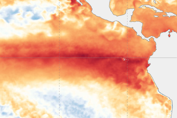
El Niño is very likely close to peak strength and is likely to continue for the next few months, while gradually weakening. Despite the expected weakening of El Niño’s tropical Pacific sea surface signature, impacts to global climate will continue for the next few months. Forecasters currently expect ENSO-neutral conditions (ENSO = El Niño/Southern Oscillation, the whole El Niño & La Niña system) by the April–June period. After that… you’ll have to read on to find out!
A bird in hand
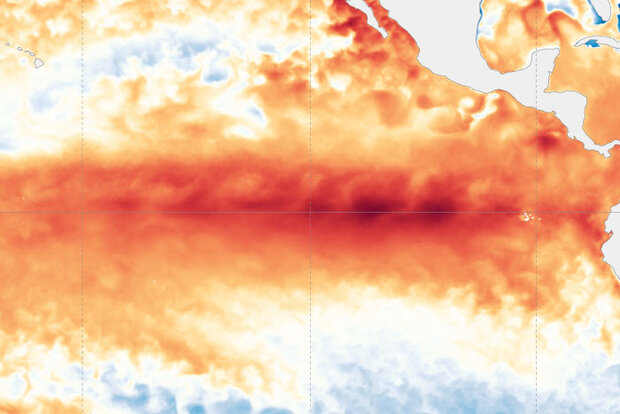
Decades of observations have shown us that it’s typical for El Niño’s sea surface temperature anomaly (anomaly = difference from the long-term average) to peak around December or early January. In …
Read article
El Niño is zipping along in the tropical Pacific. There’s a 54% chance that this El Niño event will end up “historically strong” (more details below), potentially ranking in the top 5 on record. Looking ahead, it’s likely that El Niño will end and neutral conditions return by April–June.
Sail across the Pacific
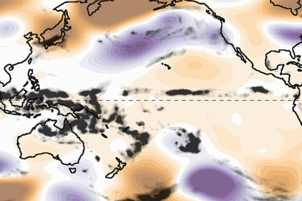
El Niño is associated with specific changes to weather and climate around the world, and the stronger an El Niño, the more likely we are to see those impacts. Of course, nothing is ever guaranteed when it comes to our complex Earth system, and the unpredictable effect of chaos may interrupt the expected impacts. For an excellent, in-depth explanation of why a strong El Niño…
Read article
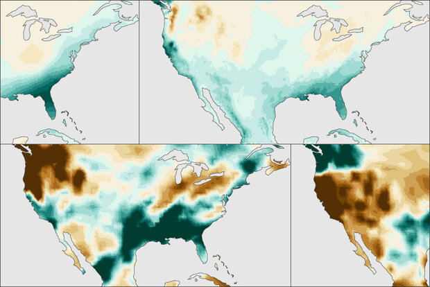
After the last three winters of La Niña conditions (weren’t we all ready for a change!), the tropical Pacific is looking much different this year, with a strong El Niño likely this winter (1). Historically, how has El Niño shaped precipitation (rainfall + snowfall) over the U.S.? Let’s dig in and find out!
What happened during December-February for previous strong El Niños?
For the 7 strongest El Niño events since 1950, wetter-than-normal conditions occurred along the West Coast and southern tier of the U.S., especially in the Southeast. This is expected because El Niño causes the jet stream to shift southward and extend eastward over the souther…
Read article