Blogs
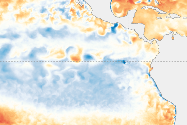
La Niña—the cool phase of the El Niño-Southern Oscillation (ENSO) climate pattern—has left the building! After a year and half of non-stop La Niña, the tropical Pacific ocean-atmosphere system has transitioned to neutral, allowing NOAA to issue its “Final La Niña Advisory”. What can we expect for ENSO through the summer and into next fall and winter? I’ll get to that!
Get outta town
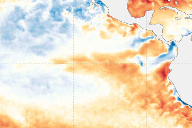
First, though, let’s bid La Niña adieu. The most recent weekly measurement of the sea surface temperature in the Niño-3.4 region (our primary monitoring region for La Niña and El Niño) was a mere -0.2°C (-0.4˚ F) compared to the long-term average. (To calculate a change in temperature in degrees Celsius to …
Read article
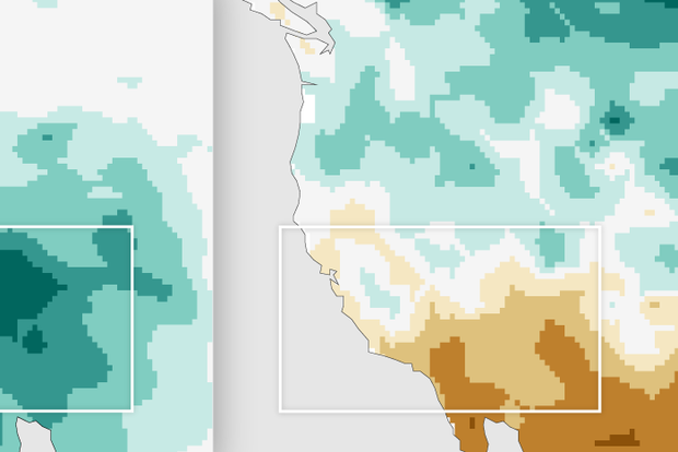
Another meteorological winter is drawing to a close, though it feels like some of us in the East are still waiting for winter to arrive (not a single inch of snow here in central New Jersey so far!). I realize that this winter has been more eventful in other parts of the country, notably in the western U.S., where torrential rains and heavy mountain snows occurred in December and January. Such heavy precipitation was unexpected prior to the season in a region afflicted with a multi-year severe drought, especially given that we are in the third consecutive winter of La Niña. How unusual were these Southwestern wet conditions in the first two-thirds of a La Niña winter? And did tropical sea su…
Read article
La Niña—the cool phase of the El Niño-Southern Oscillation climate pattern—weakened over the past month, and forecasters expect a transition to neutral conditions in the next couple of months. We’ll check in with the tropical Pacific to see how things are going before continuing the journey into understanding winter daily temperature variability that I started in December’s post.
Current events
The sea surface temperature in the Niño-3.4 region in the tropical Pacific came in at 0.75 °C (1.4 ˚F) cooler than the long-term average in January according to ERSSTv5, our most consistent historical dataset.
This is the second month in a row with that the Niño-3.4 anomaly (anomaly = ”di…
Read article
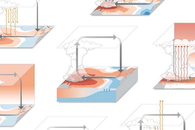
“How will climate change influence ENSO?” is one of the most common questions that we get on the ENSO Blog. While it makes sense folks want to know about the future changes in El Niño and La Niña—are they becoming more/less frequent? stronger? weaker? (1)—there is an even more basic question for future climate change that scientists are pondering:
How will trends in sea surface temperatures change across the equatorial Pacific Ocean?
It is very likely that the equatorial Pacific Ocean is going to warm up somewhere, but where exactly the strongest warming occurs is an important question. In particular, scientists want to know more about the geographic pattern of trends (2). By modifyin…
Read article
Hello from the 103rd Annual Meeting of the American Meteorological Society! Your trusty ENSO correspondent is writing to you from Denver, CO this January. (ENSO = El Niño/Southern Oscillation, the entire El Niño/La Niña system.) Today I have an overview of current conditions and the forecast, before getting back to the question I posed last month—how does ENSO affect daily temperatures during the winter? Let’s get to it, as there’s a lot of ground to cover this month!
Current events
The sea surface in the tropical Pacific has been cooler than the long-term average (1991–2020, currently) since mid-2020, and it remains so. However, we did see some weakening of this pattern over the past …
Read article