Blogs

Although it’s taking its sweet old time to get going, a weak La Niña, the cool phase of the El Niño/Southern Oscillation (ENSO), is expected to develop this winter. Much like I did last November, I thought it would be a good time to delve into how these expected tropical Pacific conditions might influence the pattern of precipitation over North America this winter. After all, ENSO—the entire El Niño and La Niña system—is the single most predictable influence on year-to-year differences in average winter precipitation across the United States. Without further ado, let’s get to it!
Break out the models!
Last November we were anticipating a big El Niño to do…
Read article

Though many aspects of nature in the Northern Hemisphere tend to quiet down during the winter, the Arctic stratospheric polar vortex (we’ll just call it the polar vortex from here on) is just getting started. Read on to get a recap of what the polar vortex is, what happened over the past summer, and what antics the polar vortex has been getting into recently.
The polar vortex: a lonely bear or party animal?
For those of you who are new to the polar vortex blog or are reminiscing over those summer polar vortex-less days, let’s start with a brief recap [footnote 1]. The polar vortex is a band of strong west-to-east winds that forms in the stratosphere between about 10 and 30 miles …
Read article

There’s a 57% chance La Niña will develop soon. This is late for La Niña to arrive, and it’s very likely to be a weak event at most. However, even a weak event can influence temperature, rain, and snow patterns across the world. Today, we’ll take a tour through current conditions in the tropical Pacific and consider some of the things that might be interacting with La Niña’s development.
First things first: what’s ENSO, and why do we care so much about it?
La Niña, the cool phase of the El Niño/Southern Oscillation (ENSO), features cooler-than-average surface temperature in the tropical Pacific Ocean. The warm phase, El Niño, includes warmer-than-average surface waters, and ENSO-neutra…
Read article

I’ll cut to the chase. Spooky season is coming to an end, and people are beginning to set their sights on winter. And when it comes to winter, there’s a big, white, abominable “elephant” in the room. Snow. While you’re not going to find a seasonal snowfall prediction here at the ENSO Blog, what we can do, given that La Niña is favored this winter, is revisit the historical relationship between La Niña and snow across North America. Just promise to not take it out on your lowly ENSO Blogger if history suggests more of a winter nightmare than a winter wonderland.
Haven’t you covered this before?
Yes…and no. Back in 2017, Stephen Baxter did indeed write a very popular post on snow and La …
Read article
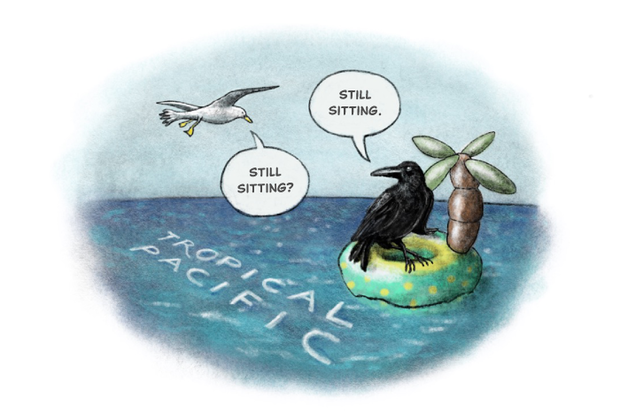
The tropical Pacific Ocean reflected neutral conditions—neither El Niño nor La Niña—in September. Forecasters continue to favor La Niña later this year, with an approximately 60% chance it will develop in September–November. The probability of La Niña is a bit lower than last month, though, and it’s likely to be a weak event.
Let my heart be still a moment and this mystery explore
La Niña is the cool phase of the El Niño/Southern Oscillation (ENSO), a pattern of alternating warmer (El Niño) and cooler surface waters in the tropical Pacific. Rising warm air in the tropics is what drives global atmospheric circulation, and therefore the jet stream, storm tracks, and resulting temperature…
Read article