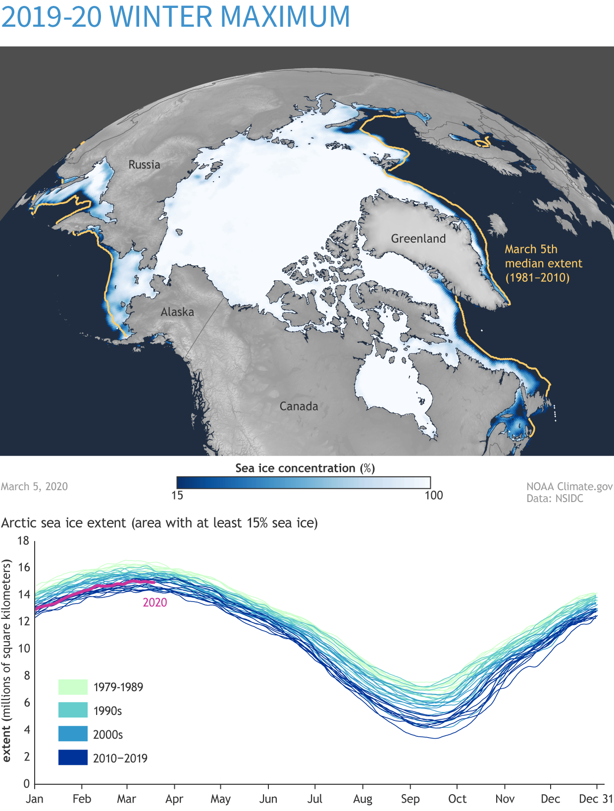
Image caption
This map shows Arctic sea ice extent on the 2020 winter maximum, March 5, 2020. The graph compares sea ice extent over the 1981-2020 satellite record. NOAA Climate.gov based on data from NSIDC.
This map shows Arctic sea ice extent on the 2020 winter maximum, March 5, 2020. The graph compares sea ice extent over the 1981-2020 satellite record. NOAA Climate.gov based on data from NSIDC.