
Image caption
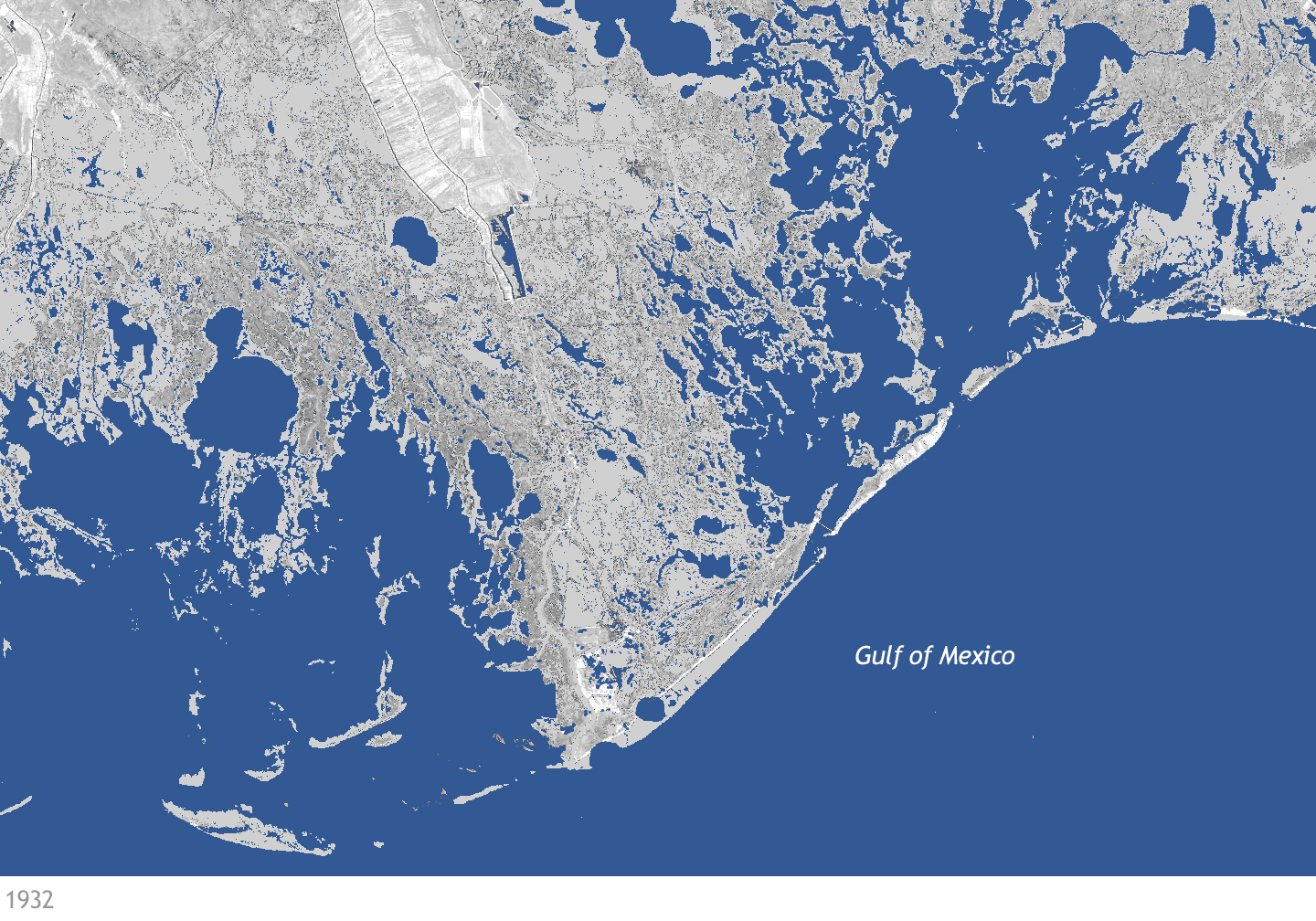
Land lost along the Louisiana coastline near Port Fourchon between 1932 and 2011. Blue areas are open water, gray areas are land areas present in both periods, and green is new land that built between the two periods. NOAA Climate.gov image, based on data from NASA and the U.S. Geological Survey.