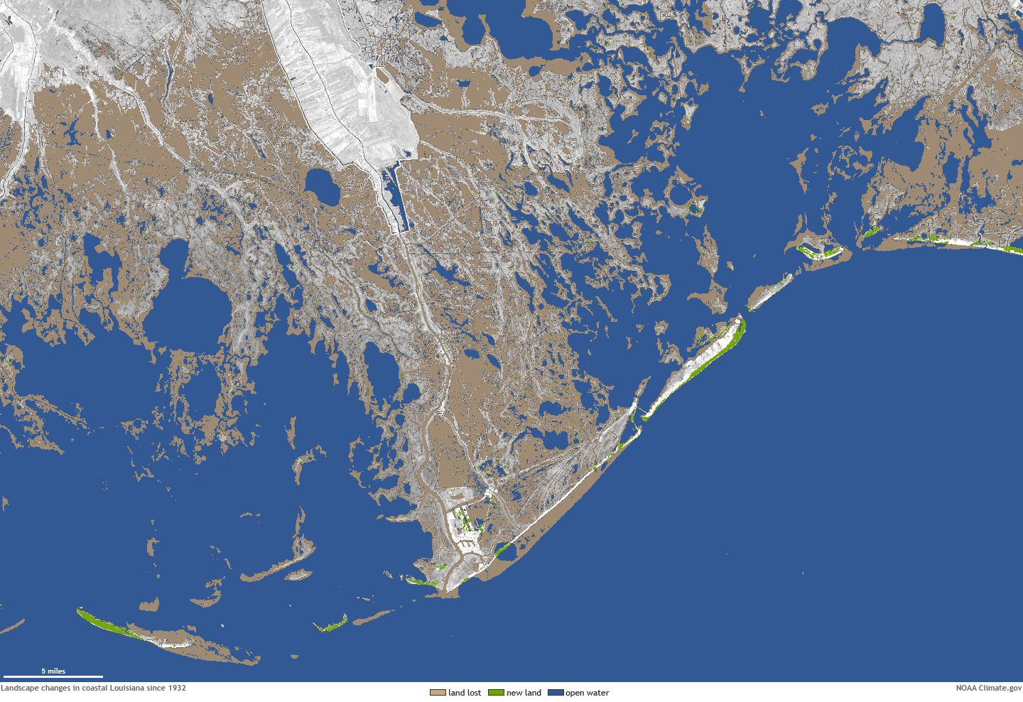
File name: PortFourchon_lostland1932-2010_HR.jpg Original Resolution (pixels): 1440 × 988 File Size: 1388 KB (MIME Type: image/jpeg) Date Published: January 26, 2022 Alternate Text: Map showing difference in land areas near Port Fourchon between 1932 and 2011 View image full size Download file
