
Image caption
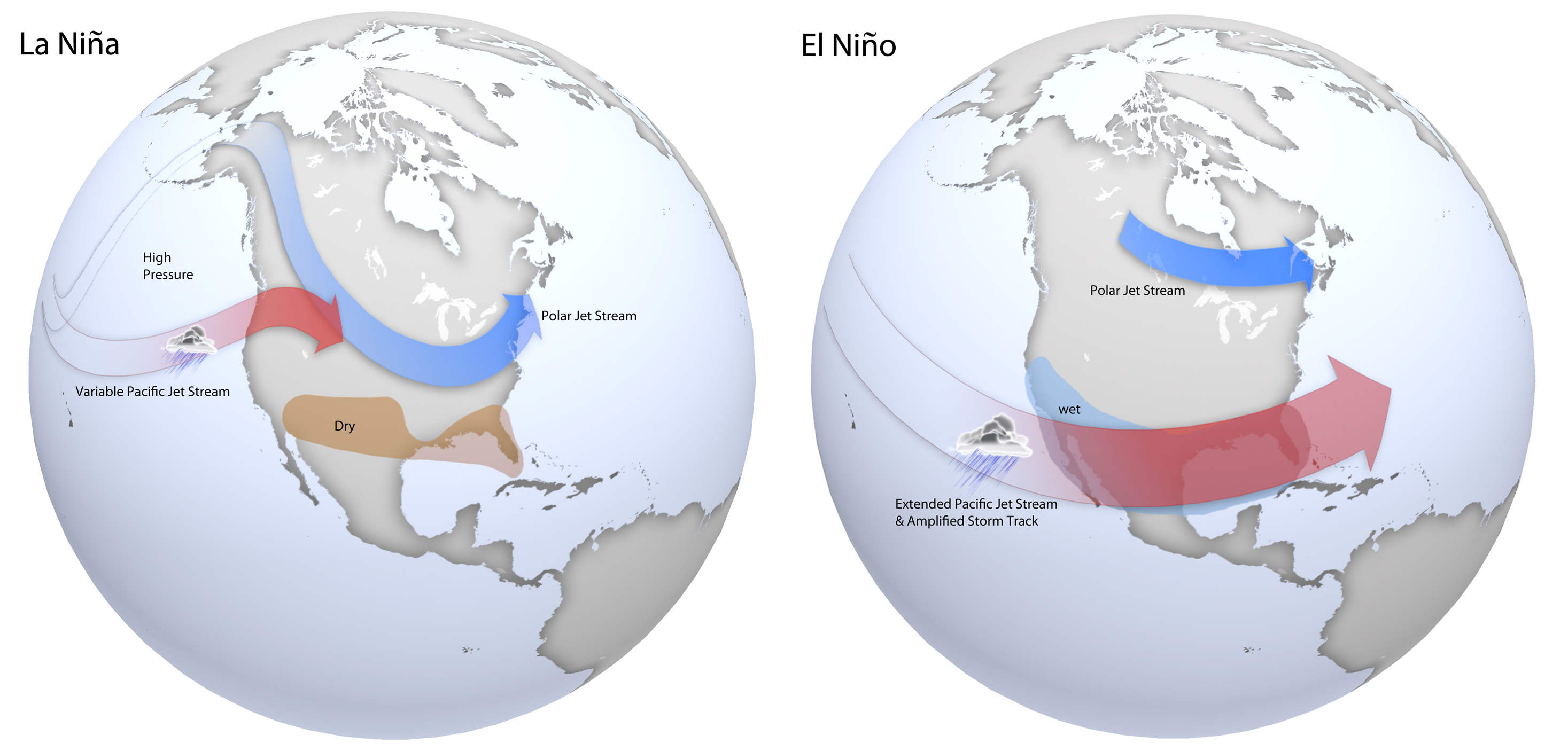
Maps of typical jet stream locations and patterns during La Niña (left) and El Niño (right) winters. Patterns are similar in spring, but are often weaker. Based on original graphics from NOAA’s Climate Prediction Center.
Maps of typical jet stream locations and patterns during La Niña (left) and El Niño (right) winters. Patterns are similar in spring, but are often weaker. Based on original graphics from NOAA’s Climate Prediction Center.