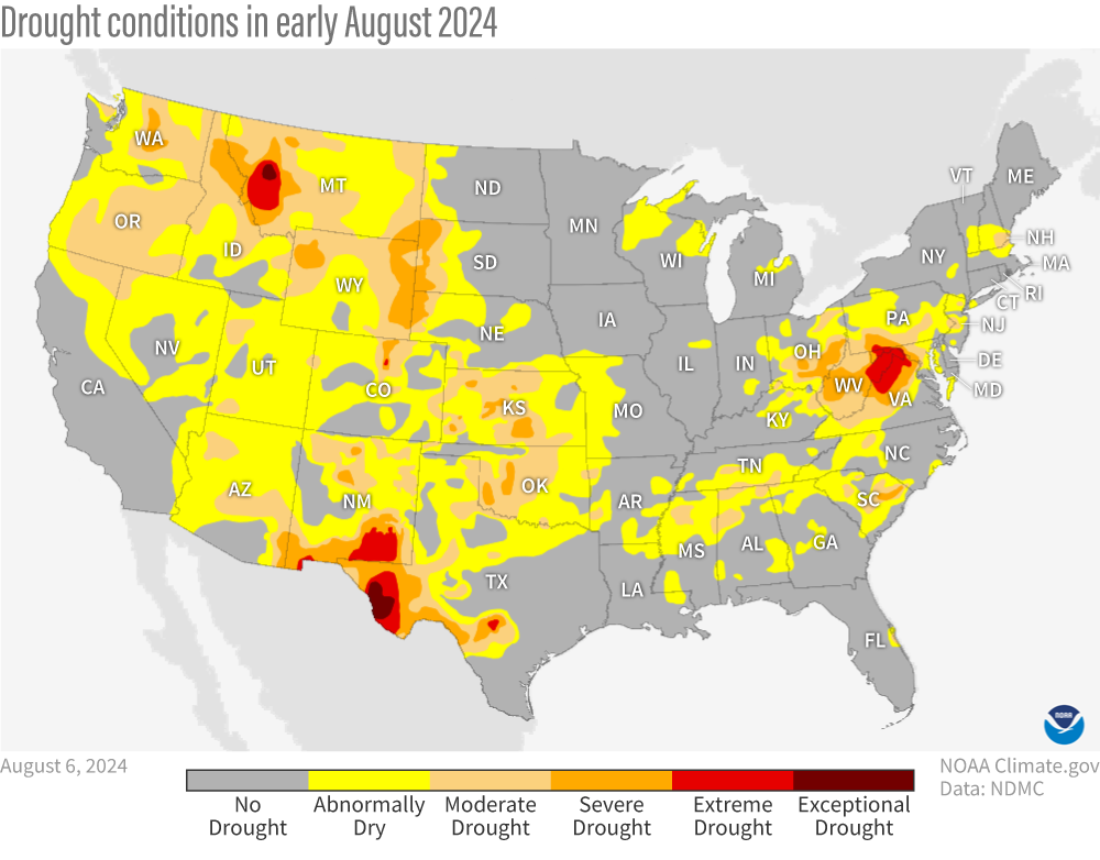
Image caption
Map of drought status across the continuous United States as of August 6, 2024. Although not officially in drought, a sizeable part of the country was abnormally dry (yellow), including most of the West and along an arc tracing out the Southern and Central Appalachian Mountains from Alabama to Pennsylvania. NOAA Climate.gov map from our Data Snapshots Collection, based on data from the U.S. Drought Monitor project.