
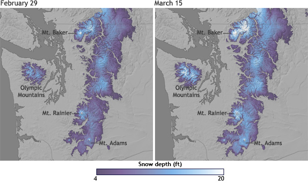
Image caption
Estimated snow depth across the Cascade Range as of February 29, 2012, and again on March 15, following a series of storms. Places where snow depth was up to 20 feet are white, while dark purple indicates at least 4 feet of snow. Dark grey represents areas where there was no snow. Based on snow depth data from the National Operational Hydrologic Remote Sensing Center.