Image caption
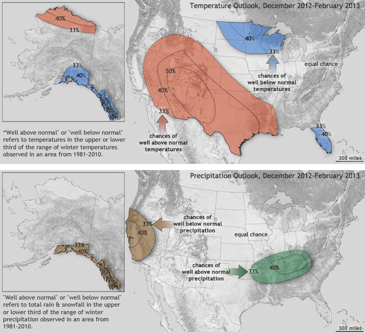
NOAA’s Climate Prediction Center issued an updated Winter Climate Outlook on November 15. Red and blue areas in the top map show the percent chances that temperatures will be in the upper or lower third of average winter conditions observed in those regions during the period from 1981-2010, respectively. The second map shows the percent chances that precipitation will be in the upper third of the observed range of winter precipitation from 1981-2010 (green) or in the lower third of the observed range (brown). No shading over an area means there are equal chances for any given temperature or precipitation conditions this winter.