
Image caption
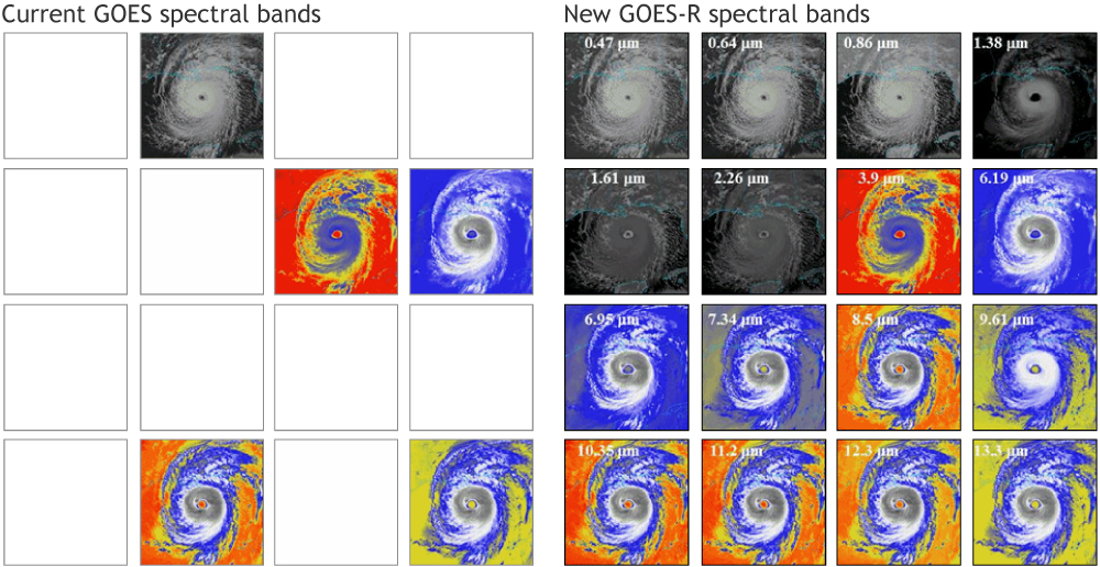
Graphic showing simulated imagery of Hurricane Katrina on the 5 channels of the current GOES imager (left) vs the 16 channels on the GOES-R imager (right). Credit: CIMMS AWG Proxy Team/SSEC/UW-Madison.
Graphic showing simulated imagery of Hurricane Katrina on the 5 channels of the current GOES imager (left) vs the 16 channels on the GOES-R imager (right). Credit: CIMMS AWG Proxy Team/SSEC/UW-Madison.