
Image caption
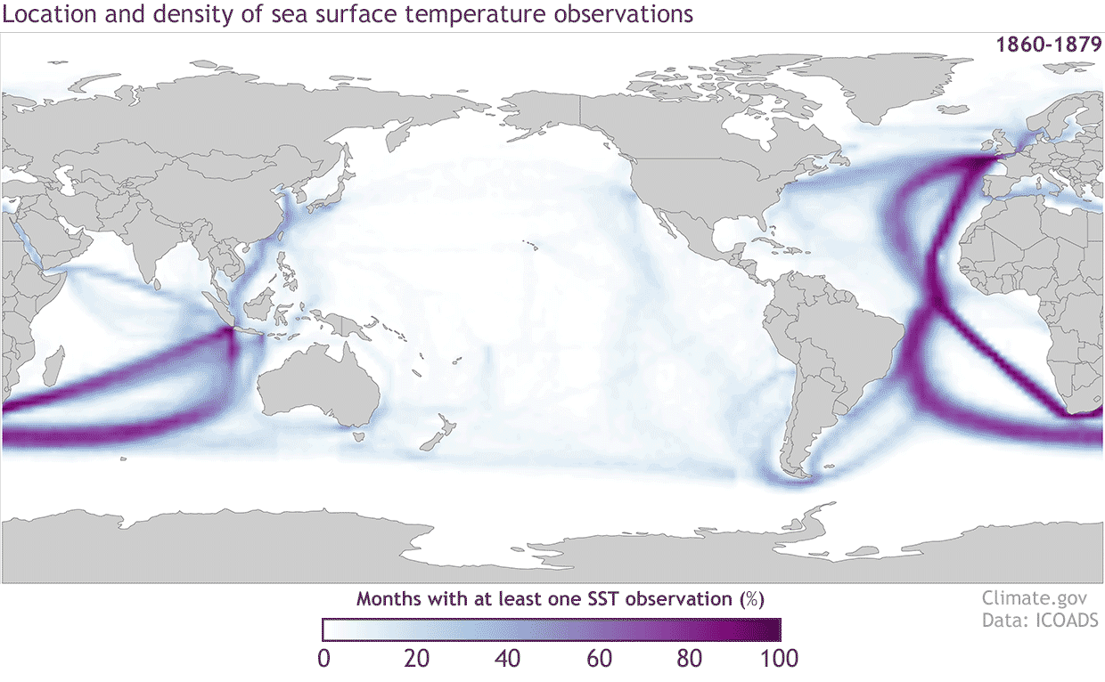
Locations of sea surface temperature observations from the International Comprehensive Ocean Atmosphere Data Set (ICOADS) for 20-year periods starting with the 1860-1879 period and ending with 1980-1999. The colors represent the percentage of months with at least one sea surface temperature measurement in each 2 degree by 2 degree grid box. The darker the color the higher the percentage of months in each 20-year period that has an observation. NOAA Climate.gov image with data from ICOADS.