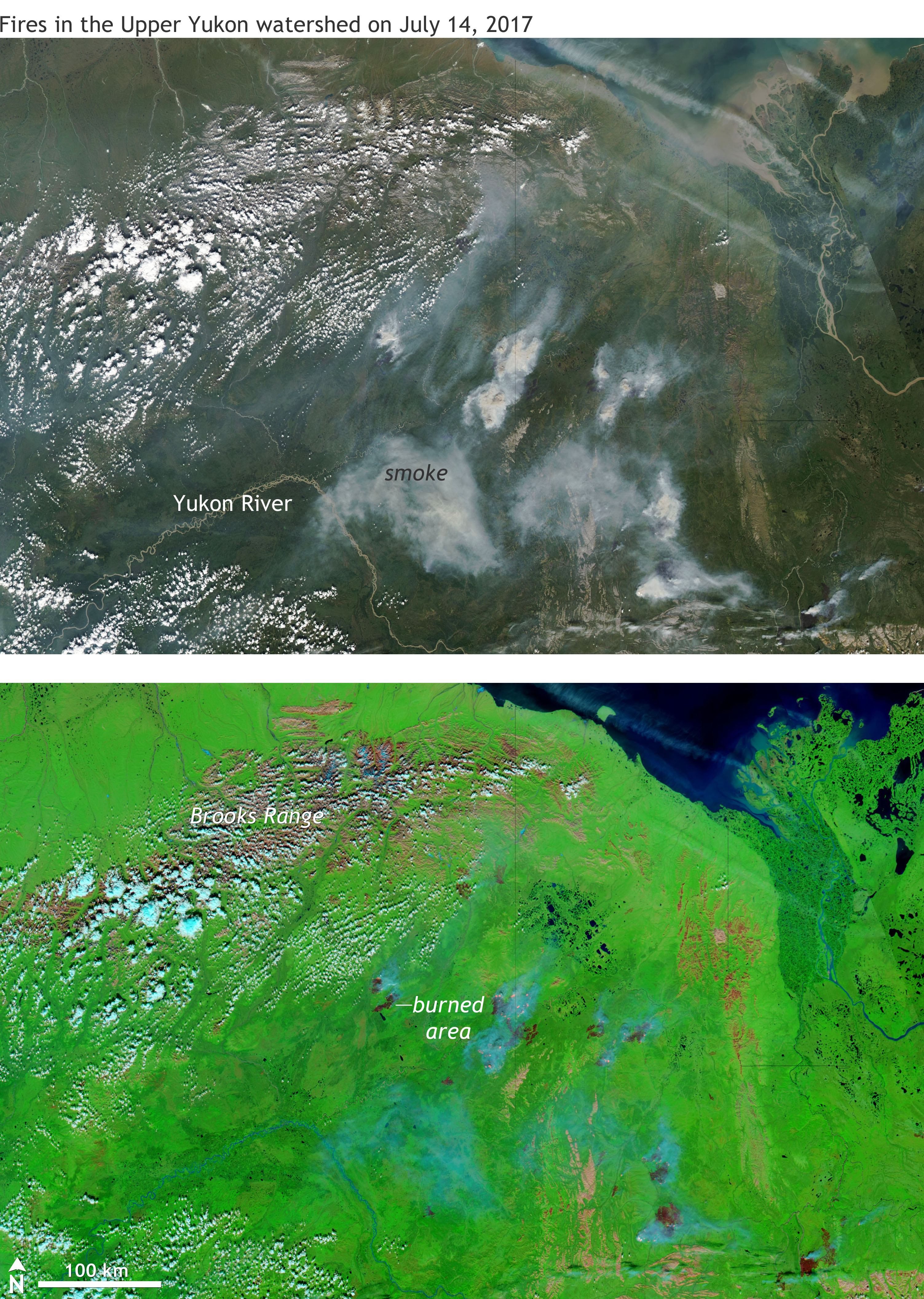
Image caption
Fires in the Upper Yukon Valley of Northeast Alaska on July 14, 2017. NASA Aqua satellite images provided by the Worldview website. The top is a photo-like image, while the bottom is a combination of visible and short-wave infrared wavelengths of light that highlights the contrast between healthy vegetation (green) and recently burned areas (dark red).