NOAA, communities to map heat inequities in 14 states, 1 international city
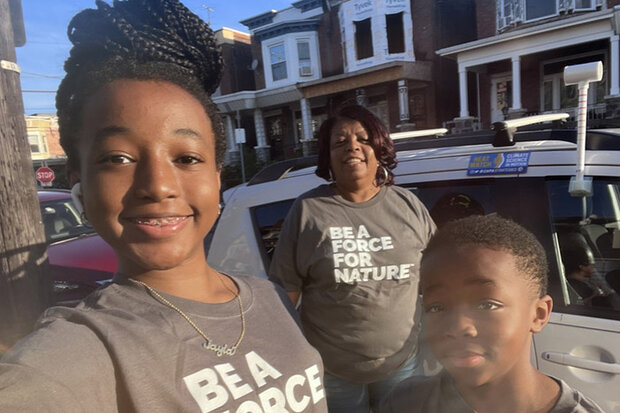
Jayla Gardner snaps a photo of herself, Jacqueline Jones, and Jaden Gardner next to the car with a heat sensor they used to gather data in Philadelphia as part of the 2022 Urban Heat Island Mapping Campaign. Credit: Jayla Gardner
Jayla Gardner snaps a photo of herself, Jacqueline Jones, and Jaden Gardner next to the car with a heat sensor they used to gather data in Philadelphia as part of the 2022 Urban Heat Island Mapping Campaign. Credit: Jayla Gardner
This summer, NOAA and citizen scientists will map the hottest parts of 18 communities in 14 states across the country and in one international city. Identifying these hotspots, called urban heat islands, helps local decision-makers take actions to reduce the health impacts of extreme heat, which often target the most vulnerable.
Now in its seventh year, the NOAA Urban Heat Island (UHI) mapping campaign addresses extreme heat, the number one weather-related cause of death in the U.S. for the last three decades. Urban heat islands — areas with few trees and more pavement that absorbs heat — can be up to 20 degrees fahrenheit hotter than nearby neighborhoods with more trees, grass and less black asphalt.
“The burden of heat is not shared equally in our urban areas,” said NOAA Administrator Rick Spinrad. “Gathering this type of environmental intelligence helps communities measure their hottest places so they can develop strategies to reduce the dangerous effects of heat. Community by community, we’re working to create a Climate-Ready Nation that is resilient in a changing world.”