Blogs
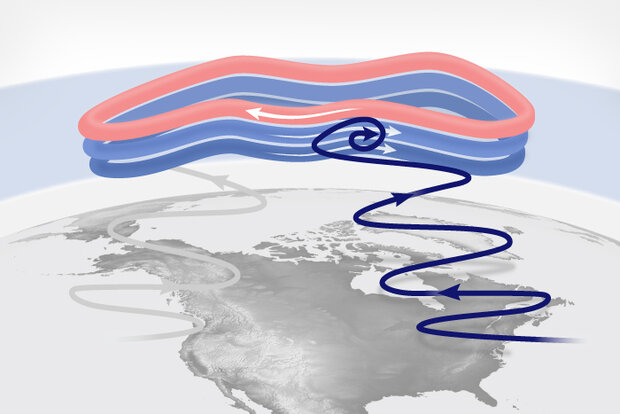
With the occurrence of a major disruption to the polar vortex (or sudden stratospheric warming) on January 16 2023 [footnote 1], one of the first questions everyone asks is “How can a disruption way up in the Arctic stratosphere affect the winds and weather far below in the troposphere?”.
A stratospheric traffic accident
Scientists have a pretty good understanding of how a reversal of the winds ~19 miles above the Arctic influences the winds at lower altitudes, at least down to about the tropopause (the altitude where the troposphere transitions to the stratosphere, ~6-8 miles above earth’s surface at the poles). As we mentioned in this post, huge planetary-scale waves in the atmospher…
Read article
Find your favorites! Here's an index of ENSO blog posts grouped a bit differently than what you get from the Climate.gov search function or what a simple listing page produces. The categories are simply the main ways that the ENSO blogging team tends to remember and talk about previous posts. Please keep in mind that everything about this index list is manual, from remembering/finding articles to include to the alphabetization of the guest authors section. I will almost certainly have missed some posts or made other mistakes. If you see a problem, feel free to point it out in the comments. I update this page a few times per year, so it will eventually get corrected.
…
Read article
Happy New Year from the ENSO Blog! With the arrival of the new year and an ongoing strong El Niño, many folks are already asking us, why isn’t the current El Niño bringing the expected wetter/drier/warmer/cooler conditions over my house yet?!
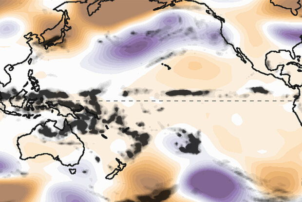
First, we’ve already seen impacts consistent with El Niño across much of the globe and those impacts have been occurring for some time now. A quick look around the world indicates some very El Niño-like impacts over the past half year (footnote #1).
Second, we’re two-thirds through January as of this writing, which means we’re barely past the midway point in the December-February season. We’ve basically just entered the January-March seaso…
Read article
Across the United States, many are experiencing the first big blast of Arctic air of 2024. Coats and gloves are emerging from the closets, and heaters are working overtime, with temperatures dropping more than 25 degrees below normal in some parts of the country. But the question on our minds…the ever-looming question everyone asks when the cold air spreads across the country … the question that motivated this blog: Is the stratospheric polar vortex playing a role in this cold snap? Read on to find out!
Stratospheric shenanigans
If we had to characterize the behavior of the stratospheric polar vortex over the last week, we’d say it’s acting…squirrely. Living up to the celebrity sta…
Read article
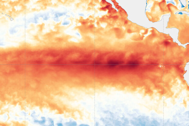
El Niño is very likely close to peak strength and is likely to continue for the next few months, while gradually weakening. Despite the expected weakening of El Niño’s tropical Pacific sea surface signature, impacts to global climate will continue for the next few months. Forecasters currently expect ENSO-neutral conditions (ENSO = El Niño/Southern Oscillation, the whole El Niño & La Niña system) by the April–June period. After that… you’ll have to read on to find out!
A bird in hand
Decades of observations have shown us that it’s typical for El Niño’s sea surface temperature anomaly (anomaly = difference from the long-term average) to peak around December or early January. In …
Read article