Blogs
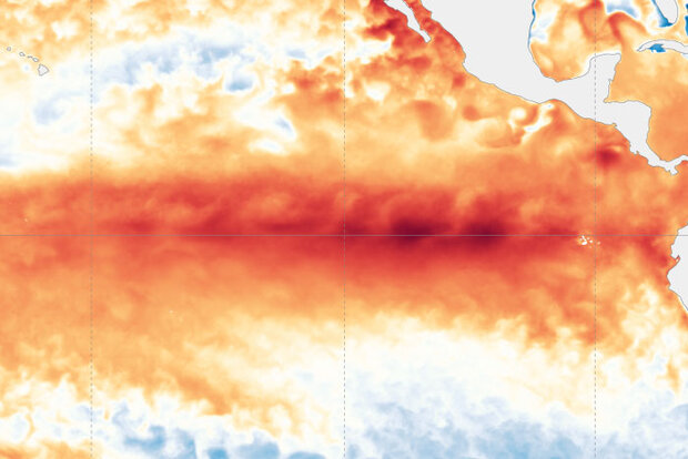
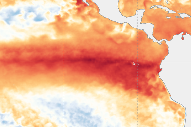
El Niño is very likely close to peak strength and is likely to continue for the next few months, while gradually weakening. Despite the expected weakening of El Niño’s tropical Pacific sea surface signature, impacts to global climate will continue for the next few months. Forecasters currently expect ENSO-neutral conditions (ENSO = El Niño/Southern Oscillation, the whole El Niño & La Niña system) by the April–June period. After that… you’ll have to read on to find out!
A bird in hand
Decades of observations have shown us that it’s typical for El Niño’s sea surface temperature anomaly (anomaly = difference from the long-term average) to peak around December or early January. In …
Read article
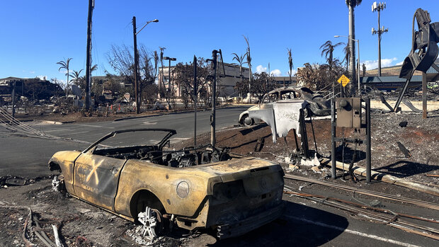
The NOAA National Centers for Environmental Information (NCEI) has released the final update to its 2023 Billion-dollar disaster report, confirming a historic year in the number of costly disasters and extremes throughout much of the country. There were 28 weather and climate disasters in 2023, surpassing the previous record of 22 in 2020, tallying a price tag of at least $92.9 billion. This total annual cost may rise by several billion when we’ve fully accounted for the costs of the December 16-18 East Coast storm and flooding event that impacted states from Florida to Maine.
2023 Highlights
In 2023, the U.S. experienced 28 separate weather and climate disasters costing at least 1 bil…
Read article
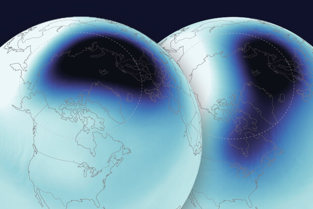
When we last wrote two weeks ago, the forecasts suggested that the stratospheric polar vortex would continue to weaken and warm into January. Though there were a few days around the end of December where forecasts moved closer to predicting a full reversal of the west-to-east winds at 60 degrees North* that comprise a major “sudden stratospheric warming”, the ingredients did not fully come together. Instead, in the last few days there was a minor warming of the vortex. Temperatures in the mid-stratosphere (~19 miles above the surface) rose about 30 degC (55 deg F!) during the 6-day period between December 30 and January 5th, and the winds at 60 degrees North slowed considerably but did not r…
Read article
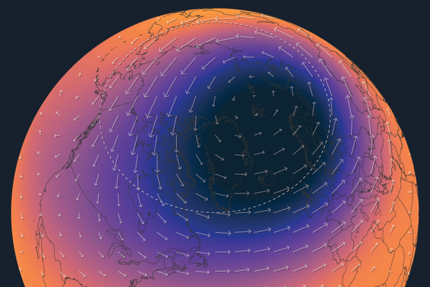
We threw plenty of information at you in our last post introducing the Arctic stratospheric polar vortex. So let’s take a step back and examine that information a little more closely. If the last post was the “meet cute” with the stratosphere, then this post is more like a first date, where we get to know the polar vortex and find out what it’s been up to lately.
Tell me more about yourself
We’ll start by taking a closer look at the average behavior of the temperature and wind patterns across the polar stratosphere throughout the year. The first thing you might notice is that the winds change direction in the late summer and spring. Or that the temperatures are colder in the winter tha…
Read article
El Niño is zipping along in the tropical Pacific. There’s a 54% chance that this El Niño event will end up “historically strong” (more details below), potentially ranking in the top 5 on record. Looking ahead, it’s likely that El Niño will end and neutral conditions return by April–June.
Sail across the Pacific
El Niño is associated with specific changes to weather and climate around the world, and the stronger an El Niño, the more likely we are to see those impacts. Of course, nothing is ever guaranteed when it comes to our complex Earth system, and the unpredictable effect of chaos may interrupt the expected impacts. For an excellent, in-depth explanation of why a strong El Niño…
Read article