Blogs
La Niña continued through April, and forecasters estimate a 61% chance of a La Niña three-peat for next fall and early winter. Current El Niño/Southern Oscillation (ENSO, the entire El Niño and La Niña system) conditions, the forecast for the rest of the year, and some potential impacts are all on the dessert menu today.
Mix the butter and sugar together
We’ll start by measuring out the tropical Pacific ocean-atmosphere system. The first ingredient in any ENSO recipe is the sea surface temperature anomaly in the Niño-3.4 region of the Pacific. An anomaly is the difference from the long-term average; in this case, the average is 1991–2020. When the sea surface temperature anomaly in…
Read article
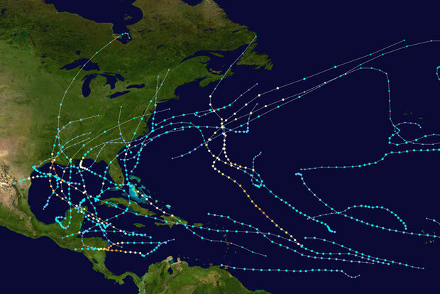
Christopher W. Landsea is the Chief of the Tropical Analysis and Forecast Branch at the National Weather Service's (NWS) National Hurricane Center (NHC) in Miami, FL. Tom Knutson is a Senior Scientist at NOAA’s Geophysical Fluid Dynamics Laboratory (GDFL) in Princeton, NJ. The following discussion represents the authors’ opinions only and does not represent any official position of NHC, NWS, GFDL, or NOAA in general. A NOAA State of the Science Fact Sheet on “Atlantic Hurricanes and Climate”, which has been reviewed by NOAA, is also available.
Last summer, one of us (Chris) co-wrote a National Hurricane Center Inside the Eye blog post about the 2020 hurricane season and whether it…
Read article
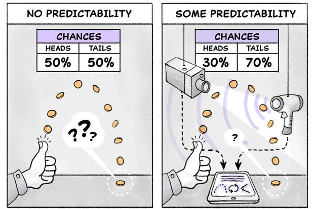
This is a guest blog by Michael Tippett (professor at Columbia University) and Tim DelSole (professor at George Mason University), adapted from material in their new text book Statistical Methods for Climate Scientists.
Predictability is a word that often comes up in discussions here on the ENSO Blog (another is variability). Let’s see if we can understand what climate scientists mean by predictability without having to read an entire book on statistics! As you might guess, climate scientists use the word predictability a little differently than the rest of the world. For instance, you might say that I am predictable because I take the same path each day on my morning walk, with small var…
Read article
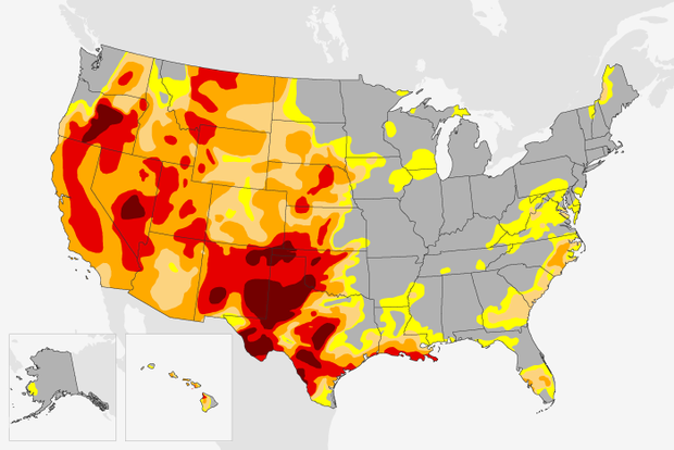
La Niña continues in the tropical Pacific, with both the ocean and atmosphere clearly reflecting La Niña conditions. The current forecast favors the continuation of La Niña through the summer (59% chance), with a slightly lower chance into the fall (50-55% chance). A third-year La Niña would be pretty unusual—we’ve only seen two others since 1950. I’ll run the numbers to see how current conditions add up and what’s factoring into the odds for La Niña later this year.
Paint by numbers
Let’s take stock of current ENSO conditions (ENSO=El Niño/Southern Oscillation, the whole ocean-atmosphere El Niño/La Niña system) in the tropical Pacific. In March, the sea surface temperature in the key …
Read article
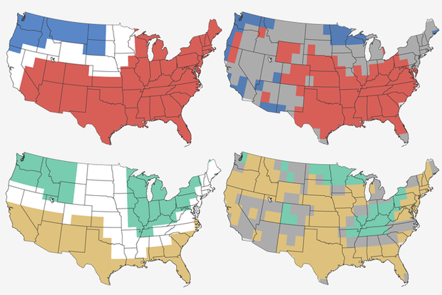
Some would call it the most famous annual March tradition. No, I’m not talking about March Madness, or St. Patrick’s Day. I’m talking about our annual look back at the Climate Prediction Center’s Winter Outlook to see how well it did.
Warning: Some math will follow. At the ENSO Blog, we’re not the types to simply give you a thumbs up or thumbs down on how well the outlook performed. That leaves us vulnerable to the whims of our human biases. Instead, we slam some cold, hard statistical math facts on the proverbial table for our readers. If you’d like a refresher, there are seven different verification posts at the ENSO Blog that I’ve written that I highly recommend you peruse.
A remind…
Read article