Blogs
I’m in San Diego this week, gazing out across the Pacific toward La Niña’s cool tropical ocean surface. (I’m not here for Comic-Con, but there are a lot of posters around the city that keep that upcoming event in the forefront.) Just over my horizon, La Niña—the cool phase of the El Niño-Southern Oscillation (“ENSO” for short)—remains in force, despite some warming in the sea surface temperature over the past month or so. Forecasters expect La Niña to continue through the summer and into the fall and early winter.
Ka-Pow!
Numbers-wise, there’s about a 60% chance of La Niña through the summer, ticking up a bit to the mid 60%s around 66% by October–December 2022. The second most like…
Read article
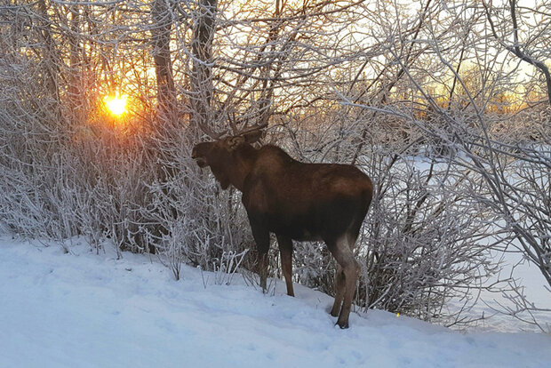
This is a guest post by Dr. Brian Brettschneider (@Climatologist49) who is a climate services program manager for the National Weather Service’s Alaska Region. In addition to being an expert on Alaskan weather and climate, he is an ENSO (and moose) aficionado, which makes him the ideal candidate to write this blog post!
Alaska is the land of cold and snow. Everything about the people, ecology, and landscape is defined by the climate. Low temperatures create permafrost zones and glaciers. Snow covers the land for four to eight months of the year. Freezes in summer months are not uncommon. Alaska is also home to some of the world’s largest moose. So why then do Alaskan people and moose care…
Read article
I’m definitely starting to sound like a broken record here! La Niña is favored to continue through the summer and into the winter. That said, chances of La Niña through summer have a fairly small edge over chances of a transition to neutral—52% for La Niña vs. 46% for neutral in July–September. There’s about a 59% chance of La Niña by early winter.
Dig deep
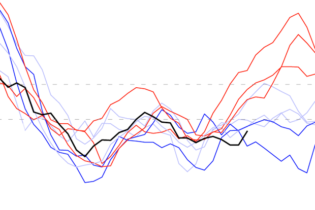
Speaking of broken records, let’s start with the sea surface temperature in the tropical Pacific. The three-month-average sea surface temperature anomaly in the Niño-3.4 region, specifically, according to the ERSSTv5 dataset. (The anomaly is the difference from the long-term average; long-term is currently 1991–2020.) This index…
Read article
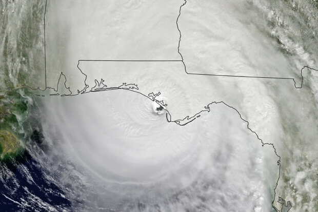
Christopher W. Landsea is the Chief of the Tropical Analysis and Forecast Branch at the National Weather Service's National Hurricane Center in Miami, FL. Tom Knutson is a Senior Scientist at NOAA’s Geophysical Fluid Dynamics Laboratory in Princeton, NJ. It should be noted that the following discussion represents the authors’ opinions only and does not represent any official position of NHC, NWS, GFDL, or NOAA in general. A NOAA State of the Science Fact Sheet on “Atlantic Hurricanes and Climate”, which has been reviewed by NOAA, is also available.
Last month, in a Beyond the Data blog post, we examined whether scientists can detect any significant change in Atlantic hurricane activity to…
Read article
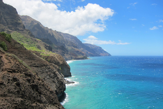
With so much focus here and elsewhere on how ENSO (El Niño-Southern Oscillation) impacts the conterminous United States, our friends in the 49th and 50th states might feel a little neglected. As a former resident of Hawai’i, I am happy to throw the spotlight onto a state that is still near and dear to my heart. Here I attempt to channel the Aloha Spirit and explain how ENSO impacts the weather of our most remote state. (Alaska, don’t worry, you’re up next month!).
Recipe for rainbows
Before I discuss any ENSO impacts, I would like to say a few words on the unique climate of Hawai’i. When I moved there in 2009, I was immediately struck by how much the rainfall can vary over such sho…
Read article