ENSO Blog
The surface of the east-central tropical Pacific is nearly 1°C warmer than the long-term average! We haven’t seen the atmospheric response that characterizes El Niño conditions quite yet, though. Forecasters estimate about an 80% chance that El Niño will form soon, and continue into the spring.
Where do I begin
Let’s run the numbers! All four of the ENSO monitoring regions in the tropical Pacific were warmer than average in October. The Niño3.4 region was 0.8°C warmer than average using the ERSSTv5 dataset with the long-term trend removed, comfortably above the El Niño threshold of 0.5°C above average.
To qualify as El Niño conditions, though, we have to see evidence that …
Read article
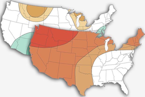
The air is starting to feel crisp, the leaves are changing, and the aroma of pumpkin spice lattes are filling your favorite coffee shops. This can only mean one thing – it’s time for my annual post on NOAA’s expectations for the upcoming winter! And once again, one of the key players is found in the tropical Pacific. In contrast with the last two years, when we were looking at potential La Niña development, this year we’re waiting to see if El Niño will arrive in time to impact winter. Without further ado, let’s take a look at NOAA’s 2018-19 Winter Temperature and Precipitation Outlook and see how ENSO has affected this forecast.
As usual: Outlooks are probabilisti…
Read article
ENSO-neutral conditions still reign as of the beginning of the month, but we’re starting to see some clearer signs of the development of El Niño. Forecasters estimate that El Niño conditions will develop in the next few months, and there’s a 70-75% chance El Niño will be present through the winter. Most computer models are currently predicting a weak El Niño event.
Goblins and ghouls
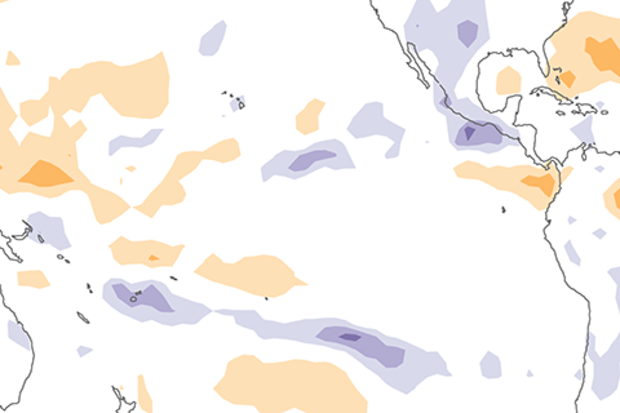
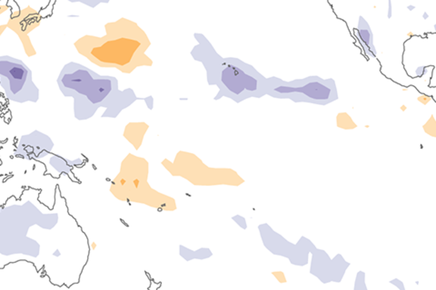
Over the past several weeks, surface temperature anomalies (difference from the long-term average) have gradually increased across much of the tropical Pacific. All four of the Niño-monitoring-region temperatures are now above average.
The temperature in the Niño3.4 region (our primary me…
Read article
At the ENSO blog we’ve spoken previously of the latest research into human-caused climate change and El Niño Southern Oscillation (ENSO). So you might be thinking, “Why another article? Didn’t you cover everything already?” Well, first of all, new science comes out all the time and, second, this time instead of looking at ENSO itself, we are going to talk about climate change’s influence on ENSO’s impacts far away from the tropical Pacific Ocean.
Specifically, we are going to look at provocative recent research that suggests that while we may not know exactly how ENSO itself will change in the future, ENSO’s impacts on temperature and wildfire probability in places like North America are …
Read article
What’s happening in the exciting world of ENSO prediction? I’ll tell you! While neutral conditions reign right now, we’re still expecting El Niño conditions to arrive later this fall (50-55% chance). By winter, the chance of El Niño conditions increases to about 65-70%.
The now
Things are definitely looking pretty neutral right now in the tropical Pacific. The most recent weekly temperature in the Niño3.4 region, our primary index for monitoring the El Niño-Southern Oscillation (ENSO), was 0.3°C above the long-term average. Most of the equatorial Pacific surface water temperatures are slightly above average, while some areas of slightly cooler-than-average sea surface waters have recen…
Read article