Blogs
After spending much of the season with super strong wind speeds, the polar vortex bowed out two weeks ago, with the core west-to-east winds sliding off the pole. However, as it winds down for the season, the polar vortex still has a few tricks up its sleeve.
The polar vortex is down but not out…yet
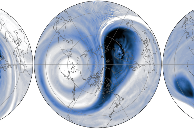
On March 9 [footnote #1], the stratospheric winds at 60°N transitioned from westerly (from the west) to easterly (from the east), indicating a major disruption to the polar vortex. Now that doesn’t mean the polar vortex has completely disappeared just yet. As the animation shows, the vortex moved off the pole, meandering around over Northern Europe.
The latest forecasts sugg…
Read article
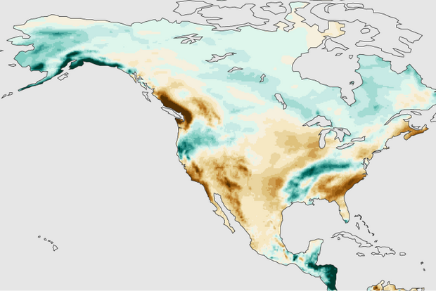
While many of us in the U.S. are reveling in the excitement of college basketball tournaments and trying to win our March Madness pools, it’s also a good time to look back at this past winter’s (December 2024– February 2025) precipitation pattern over North America. Were the seasonal forecast models a winner or a bust this winter? Was La Niña a star or a benchwarmer? Let’s go to the videotape!
Pre-Season polling
Early last December, I wrote about the predicted winter North American precipitation pattern from a group of state-of-the-art computer forecast models, the North American Multi-Model Ensemble (NMME). At that time, I argued that the forecasted precipitation pattern was…
Read article
La Niña conditions persisted through February, but forecasters expect ENSO-neutral conditions to develop in the next month and persist through the Northern Hemisphere summer.
ENSO
La Niña is the cool phase of the El Niño/Southern Oscillation, or ENSO, a pattern of changes in the tropical Pacific Ocean and the atmospheric circulation over the tropical Pacific that persists for many months. La Niña’s signature is cooler-than-average surface water in the east-central tropical Pacific, stronger-than-average trade winds, more rain and clouds over Indonesia, and drier conditions over the central Pacific. El Niño is the opposite, with warmer-than-average surface water and weaker atmospheric c…
Read article
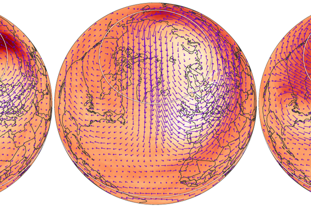
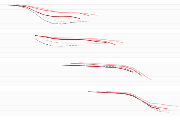
For much of this winter season, the polar vortex winds at 60°N have been racing around the stratospheric polar region. During February alone, these west-to-east winds were two times stronger than normal for that time of year. However, the latest forecasts suggest that the polar vortex is about to switch gears with a major vortex disruption to happen this weekend. Read on to find out why the polar vortex could be bottoming out early this season.
Stratospheric pit stop
At the time of writing this post, the polar stratospheric west-to-east winds are still speeding around the Arctic [footnote #1], but forecasts suggest they are not only going to come to a screeching halt by the weekend…
Read article
In the, roughly, 250 years of the ENSO Blog and our 3.4 million posts, we’ve discussed ad nauseum how complicated El Niño and La Niña are, and how difficult it is to forecast all of the ENSO nuances. Heck, I even wrote a three-part series 75 years ago that evaluated all of our seasonal forecasts (ok, it was 2014-2015 but it still feels that long ago). In a new paper, Azhar Ehsan, friend of the blog and a member of NOAA’s ENSO forecast team, and colleagues analyzed over 20 years’ worth of climate model forecasts of ENSO and found some interesting results.
Why is this paper unique? Well, most seasonal forecasting evaluations focus on model hindcasts, which are forecasts run using past obser…
Read article