Blogs
ENSO-neutral conditions continue and are expected to remain through the fall. Let’s hit the road (virtually) and take a trip around El Niño/Southern Oscillation land! Who needs Carhenge when you have the Walker circulation?
Buckle your seatbelts
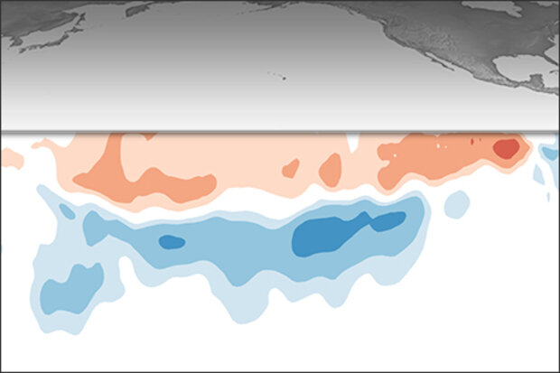
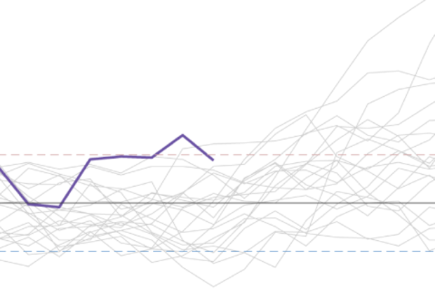
Perhaps you recently looked at the table of historical ENSO episodes, where the Oceanic Niño Index is recorded. This index, the three-month-average sea surface temperature anomaly in the Niño3.4 region (anomaly = departure from long-term average), is our primary metric for ENSO. (In climate prediction, we refer to any three-month-average period, e.g. February–April, as a season, so I’ll use that going forward here.)
Perhaps you looked at the…
Read article
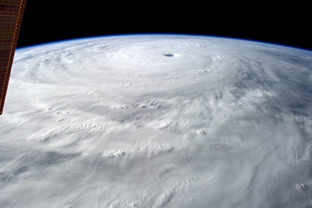
Hurricane season is approaching, and NOAA’s hurricane season outlook will be released in May. While we await that, and in the midst of an ENSO-neutral period, I thought I’d share with you what I recently learned about how human activities may be affecting tropical cyclones. (Tropical cyclones go by different names, depending on where they are—hurricanes in the Atlantic, typhoons in the western Pacific, and cyclones in the Indian Ocean—but they’re all the same type of storm.)
In January—just a few months ago, although it feels like a million years—I attended a meeting in Miami where Adam Sobel, one of our early ENSO Blog guest authors, showed some of his team’s research about tr…
Read article
It’s a new month, but it seems like an entirely different world as we peer at the tropical Pacific Ocean. Sea surface temperatures remained warmer than average, but the tropical atmosphere shifted away from its El Niño-ish appearance during February. The lack of coupling between the ocean and atmosphere leads forecasters to once again favor the continuation of ENSO-neutral with a ~60% chance during the summer, and remaining most likely during the autumn.
Share Your Screen
In the last month, ocean surface temperatures in the Niño-3.4 region have been bubbling around +0.5°C, our El Niño threshold. If you look at monthly averages …
Read article
Normally I start off blog posts with some poorly done joke. But in light of what’s going on in 2020, I’d first like to say that I hope all of our readers stay safe and healthy. We write about climate science not only because we love it (the science part…the love of writing part is more up to the blogger) but because we like people and helping them better understand our world. Without our readers, we wouldn’t have a blog.
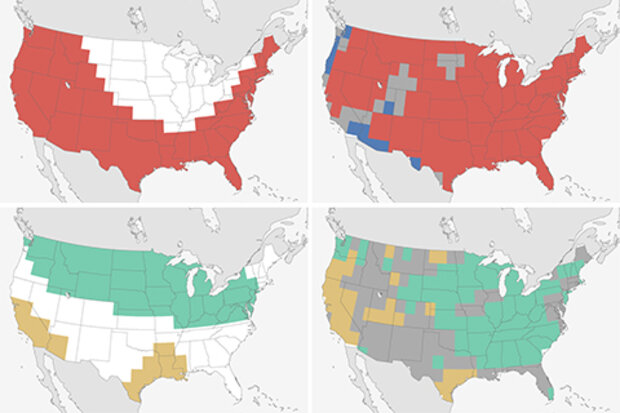
With that said, it’s March! A month I circle on the ENSO Blog calendar every year because March means I get to write our verification post for the Climate Prediction Center’s Winter Outlook. Sometimes this article is full of deserved praise for an amazing forecast. Other …
Read article
The ocean surface in the central tropical Pacific has been warmer than the long-term average for a few months now, but overall the ocean-atmosphere system is still in neutral—neither El Niño nor La Niña. The El Niño/Southern Oscillation (ENSO) forecast team estimates about a 65% chance that the tropical Pacific will continue in ENSO-neutral this spring, and about a 55% chance neutral will remain through the summer. We’ll take a spin through the current situation, and lay out some of the puzzle pieces forecasters look at when assembling a picture of ENSO in the future.
Jigsaw
First, though—does anyone remember why we spend so much time and energy predicting the evolution of the temperat…
Read article