Blogs
We’re finally starting to get through the spring barrier, when climate models have a harder time making successful forecasts. Forecasters estimate the chance of El Niño forming is about equal to the chance that neutral conditions will continue: both are just shy of 50% through the fall. Unlike two years ago, when the signal that a strong El Niño was developing was clear, most of our prediction tools are suggesting very borderline conditions, making it a tough forecast.
Current events
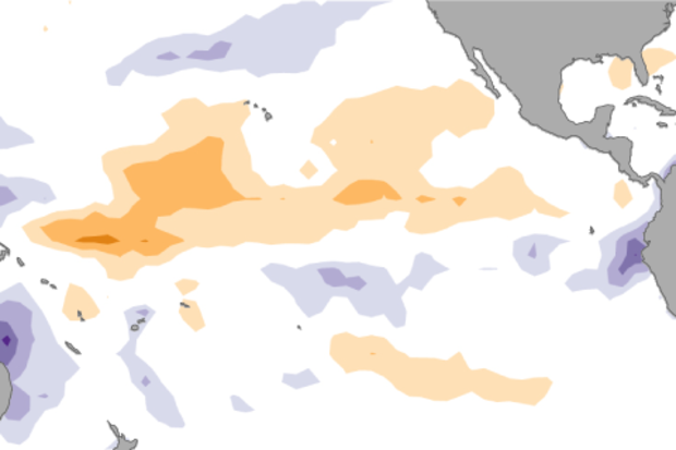
Ocean temperatures in the Niño3.4 region have been in neutral territory for a few months now, shifting from slightly cooler than the long-term average to about 0.4°C (0.7°F) warmer than average during Apri…
Read article
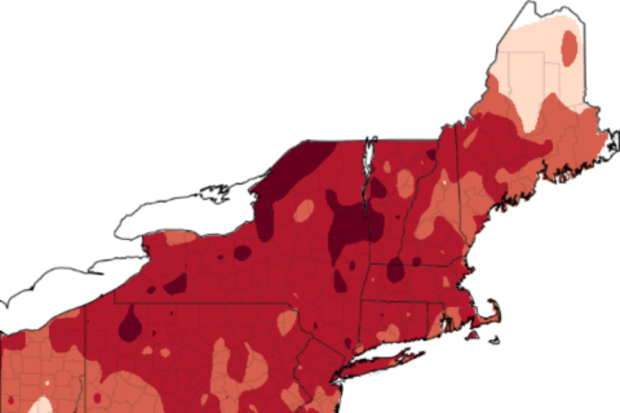
Yet another warm February has left apple growers worrying if their crops will survive below-freezing spring temperatures, a substantial concern given the annual value of the Northeast apple crop exceeds a quarter of a billion dollars. February 2017 temperature departures, as measured by Global Historical Climatology Network (GCHN) stations in the region, were eerily similar to those in 2012, when abnormally high temperatures in February and early March accelerated bud development before temperatures in the low 20s later in March and again in April severely damaged the blossoms, resulting in significant crop losses. Similar conditions last winter also resulted in abnormally high f…
Read article
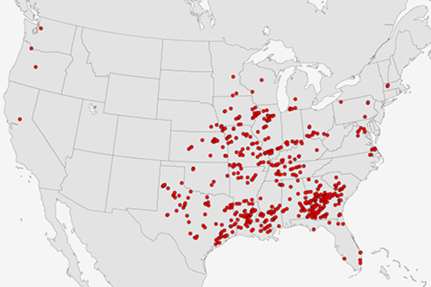
The 2017 U.S. severe weather season has jumped out to a fast start with above-average numbers of tornado, hail and wind reports. (Check out NOAA’s Storm Prediction Center for severe weather reports and summaries.) Most of the tornadoes reported were in the southern U.S., relatively close to the warm waters of the Gulf of Mexico, but several tornadoes touched down unusually far north for this time of year, including 2 EF-1 tornadoes in Massachusetts on Feb 25, 2017 and 3 EF-1 tornadoes in Minnesota on March 6, 2017.
Is there a reason for the recent spate of U.S. severe weather? What makes one season or year have more tornadoes than another? Can we blame ENSO? Since this is the EN…
Read article
In keeping with the spirit of our blog, we’ll take a look at something obvious from the NCEI monthly climate analysis, then dig a little harder into some even more pertinent climatological truths.
1. March was warm - a lot warmer than you might think.
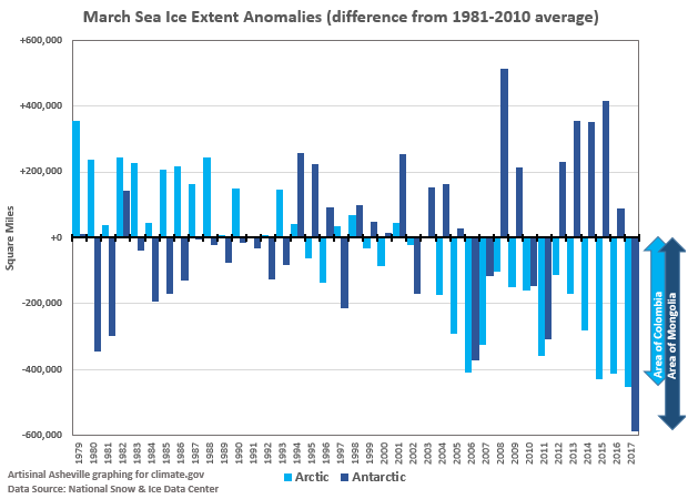
Our monthly State of the Climate report found that March 2017 was the second-warmest March on record for the globe. Just about any way you slice it, it was second only to 2016 in the history of global-scale temperatures for March. But, as we’ve pointed out in this space before, sometimes it’s human nature - or perhaps American nature - to interpret “second warmest” as “not all that warm.”
But it’s worth a closer look, in two dime…
Read article
The tropical Pacific Ocean has been giving mixed signals recently, making a forecaster’s job even more difficult! In short, many of the computer models we use are predicting the development of El Niño over the next several months, but current conditions in the tropical Pacific aren’t showing many of the elements we’d expect ahead of a developing El Niño.
We’ve had neutral ENSO conditions since January, and forecasters predict that continued neutral is the most likely scenario through at least June. By September, chances of El Niño rise to about 50%, a slight edge over neutral (~40% chance) or La Niña (~10% chance).
What are forecasters seeing now?
We rely on prediction models becaus…
Read article


