Blogs
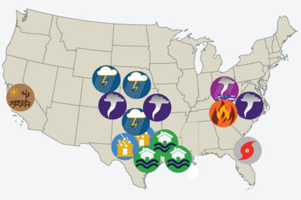
NOAA’s National Centers for Environmental Information (NCEI) tracks U.S. weather and climate events that have great economic and societal impacts (www.ncdc.noaa.gov/billions). Since 1980, the U.S. has sustained 203 weather and climate disasters where the overall damage costs reached or exceeded $1 billion (including adjustments based on the Consumer Price Index, as of January 2017). The cumulative costs for these 203 events exceed $1.1 trillion.
The year 2016 was an unusual year, as there were 15 weather and climate events with losses exceeding $1 billion each across the United States. These events included drought, wildfire, 4 inland flood events, 8 severe storm events, and a tropical cy…
Read article
In this edition of Beyond the Data, we’ll look back at 2016 and identify some of the most meaningful climate and weather events from the year.
First, the disclaimers
This is not a “top five” list of the biggest weather and climate events of the year. There are plenty of those running around. It’s simply one climate scientist’s view about selected important climate happenings of 2016, and why they speak to our understanding and experience with long-term climate.
Warmest year (probably) on record, globally.
What happened:
It was another important year for what is perhaps the most overused climate change indicator out there: globally-averaged surface temperature. This metric is v…
Read article
As Emily wrote two weeks ago, weak La Niña conditions are present and favored to continue through mid-winter of 2017. Even though the La Niña is weak and not expected to last very long, it is only fair here at the ENSO blog to give it and its impacts to the jet stream and to the United States some further elaboration.
So what about La Niña?
Yeah! What about La Niña? Can’t we show some love to the flip side of El Niño. In a previous post, Tony described, in detail, how El Niño can lead to global impacts through strengthening the Hadley Circulation where air rises near the equator, spreads towards the poles and sinks back to the surface in the subtropics (~30°N/S). This strengt…
Read article
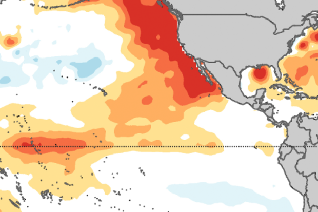
La Niña’s clinging on by her fingernails! If last year’s big El Niño was likened by some (not us) to a certain monster lizard, this La Niña is more like a gecko. Weak La Niña conditions were present during November, and are favored to continue through the mid-winter. It’s looking more likely that the tropical Pacific will transition to neutral conditions by the January – March period.
The temperature of the ocean surface in the Niño3.4 region in the east-central tropical Pacific was about 0.9°C below average during November using the ERSSTv4 data set, and the September – November period was about 0.8°C below average. This is the third three-month period in a row below the La Niña threshol…
Read article
This is a guest post by Prof. Daniel J. Vimont (@DanVimont) of the University of Wisconsin Center for Climatic Research. His group focuses on mechanisms of climate variability and change, the intersection between weather and climate, and global and regional impacts of climate change. Apparently, he also likes to fly fish.
One of the things that climate scientists (not to mention disgruntled California residents who had been hoping for a drought-buster) can’t stop talking about is how the strong El Niño of 2015-16 just didn’t act like previous El Niños in many respects. Part of that discussion involves other climate patterns that operate in the Pacific Ocean and how they work to enhance o…
Read article