Blogs
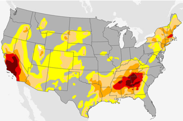
Drought has erupted in the Southeast United States in recent months, and emerged in the central plains in recent weeks. Forest fires have dotted the Southern Appalachians. Areas not directly threatened by the fires have dealt with the downstream consequences. Many places—including here in Asheville—have seen an almost uninterrupted run of air quality alerts. My part of the country now faces some of the same challenges many Californians have been battling for several years.
How we got there
The short version of how we got there, and this isn’t meant to sound flippant, is that it’s been dry and warm.
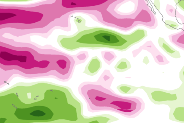
Take a look at October’s “percent of normal” precipitation map. The darke…
Read article
Let’s take a tour through the La Niña diagnostic flowchart…
Is the sea surface temperature in the Niño3.4 region more than half a degree cooler than average? Yes! (It was about -0.7°C below average during October.) Do forecasters think it will stay cooler than that threshold for several overlapping three-month periods? Yes! (But just barely.) Finally, are there signs that the atmospheric circulation above the tropical Pacific is stronger than average? Yes! This all means that La Niña has officially arrived.
First things first
The Niño3.4 Index—the temperature of the ocean surface in a specific region of the equatorial Pacific, and our primary metric for measuring El Niño and La …
Read article
Will we or won’t we see La Niña emerge this year? Does it even matter? Shoot, if one of the strongest El Niño episodes in history didn’t deliver much drought relief to California last winter, what are the chances for significant improvement this year? I’ll attempt to answer these and other questions here in my 5th blog post. If you'd rather watch a video recap of the winter outlook, we have that, too.
This blog is brought to you by the letter p, for “probability”
So what might influence our climate this winter? As you know from the ENSO blog, there is a link between the fall and winter conditions across the tropical Pacific and the average winter climate in …
Read article
Last week’s Beyond the Data post examined the extreme temperature climates in the United States, as defined by station “normals.” We promised to come back and look at the precipitation extremes, and here we are.
First, a reminder: this information, for a subset of about 450 stations across the United States, is available through this tool. We’ve left the settings at the default “don’t give me stations within 20 miles of each other” setting. Jump in and play with the data yourself!
The Wettest and Driest Places in America
The tables below list the ten wettest and ten driest locations in the United States. Again, these are annual normals, or what would be expected in the mythica…
Read article
What a difference a month can make! Since my last post, the tropical Pacific has changed gears, and now forecasters think there’s a 70% chance that La Niña conditions will develop this fall. However, any La Niña that develops is likely to be weak, and forecasters aren’t quite as confident that La Niña conditions will persist long enough to be considered a full-blown episode, giving it a 55% chance through the winter.
Ch-ch-ch-changes
When I wrote last month, the tropical Pacific wasn’t giving us much evidence that the atmosphere was responding to the slightly cooler-than-average ocean surface, and most of the computer models were predicting that sea surface temperatures would head back…
Read article