October 2024 is likely to be one of the driest months ever recorded for the country. Will these dry conditions persist into November or will autumn precipitation make a return to portions of the country?
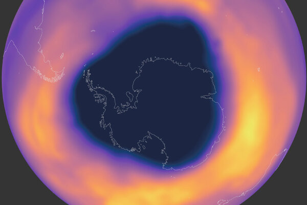
Watch the Antarctic ozone hole develop in 2024
October 30, 2024
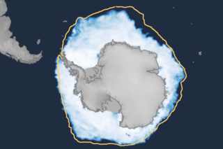
2024 Antarctic sea ice winter maximum second lowest on record
October 8, 2024
The highest odds for a much warmer than normal and much drier than normal October are across the western and central parts of the country.
The lowest 18 sea ice extents on record have all occurred in the last 18 years (2007–2024).
August was 15th consecutive month of record-setting global temperatures, and it brought the second-lowest August sea ice extent in the Antarctic.
There have been plenty of episodes in this season's La Niña Watch. Our blogger recaps what's happened so far and what we can expect in the upcoming months.
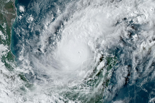
Three tropical systems brought heavy rain and wind to the U.S. and its territories in August; it was the fourth-warmest summer on record for the contiguous U.S., and many cities were gripped by record heat.
The highest odds for a much warmer than normal September are in the central West and southern Florida. The highest odds for a much drier than normal September are in the Upper Midwest.