Earth had its warmest year on record, while upper-ocean heat content also experienced a record high.
Is the polar vortex to blame for this recent cold air outbreak? We don’t think so. This seems like a case of the polar vortex getting blamed for being a trouble maker, when it was actually minding its own business.
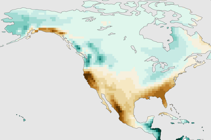
Models and other forecasting tools favor a warm West/cool East temperature split in January along with a wet Northwest/dry Southwest precipitation split.
What are the odds of a stratospheric polar vortex disruption this winter? We take a look at two things that help predict our chances for this extreme event.
Among the changes, the Arctic tundra is now releasing more carbon dioxide to the atmosphere than it stores.
Big things sometimes come in small packages, and our blogger explains why this winter’s expected weak La Niña might have a bigger precipitation impact than usual.
Though many aspects of nature in the Northern Hemisphere tend to quiet down during the winter, the stratospheric polar vortex in the Arctic is just getting started.
Heat-driven drying is playing a larger role than low precipitation in 21st-century Western droughts.
It was the second-warmest October for the globe, and large parts of North and South America were drier than average.
Drought expanded rapidly across the country during October, with near-record warmth and dryness dominating large portions of the Lower 48.